Explore climate diagrams from all parts of the world
There are two useful sources for climate diagrams from all around the world - right here at your fingertips!
First, a very useful website to generate climate diagrams for you using global climate datasets is http://climatecharts.net. Here you can search and explore virtually all parts of the world - generating maps and seeing the monthly climate data. N.B., this website uses colors in place of sots and vertical lines to indicate drought and humid periods.
Second, Walter's 1975 global book of climate diagram maps is the gold standard. However, the book is scarce and largely unavailable to students. However, click below to see climate diagrams maps for locations across each of the continents.
|
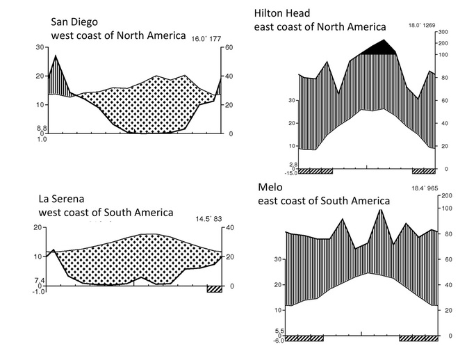
As you explore climate diagrams for different parts of the world, you will quickly notice that the climate at equivalent latitudes is quite different on the east versus west side of the continent, as shown to the right. Not surprisingly, when you visit these sites virtually using confluence.org, you notice quite a different in vegetation at the same latitudes! |
|
If you have the talent and can program in R, then Ben Campbell has created very useful code in R that allow you to generate true Walter climate diagrams.